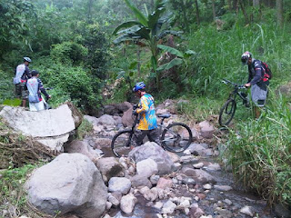
This is one bike track is quite challenging for me, even though the distance is not too far only 26 km and is dominated by derivatives, but very draining because at that point a certain point there is a fairly steep climb and many encountered several obstacles that force us to even hold TTB bike as a barrier creek, trees uprooted and some very steep stairs steps.
Type of surface tracks vary widely from macadam road, the black stone structure, dike fields, etc. but most of the grass track is quite difficult because the current high grass making it difficult to discern which way is not the way, luckily we were assisted by GPS GARMIN GPSMAP 76CSx is always faithful to accompany although some times we stray away from the tracks we've uploaded on the gps
The view is quite beautiful and cool because of the lush pine forest dominated but a quiet atmosphere in the woods is enough to make us a bit nervous especially amid the forest we passed two graves, we do not know it because around the tomb of whom there is no home residents who could be questioned but if you look form which are permanent tomb and given a roof joglo, deceased who are buried there, it should include important figures
Once out of the pine forest along the 8 km of asphalt road we met with the village as well as a coffee shop where we took a break to drink tea and eat some snack such as tofu paste, fried bananas and knew the contents, being tired, tired along the way seemed to disappear after spending two glasses of hot tea and a few pieces out, so it's ready to devour the next track to finish in Mojorejo Restaurant on Highway Purwosari - Gempol.
You can download the .gdb file (Garmin MapSource) and .kmz file (google earth) at www.tracksepeda.com (please login or register it first )
Keep on tracking
The following description of the google earth map, profile and photos:
Tuesday, May 3, 2011
Subscribe to:
Post Comments (Atom)


No comments:
Post a Comment